Characters in Character
by Compass Rose Navigators
Bringing history to life
“Tell me and I forget, teach me and I may remember,
involve me and I learn.”
― Benjamin Franklin

Battlefields (Civil War/War Between the States)

The Charcters have experienced and been a part of many reenactments, like the one pictured here in Southern California put on by the Boy Scouts.
Battles detailed are: Appomatox, Manassas (1&2), Atlanta Campaign, & March to the Sea
The Last Battle: Appomattox
Appomattox Batllefield (VA)
Ironically, the first ground battle (Manasses) and the last (Appomatox) were fought on the same person's property! Fleeing after the first Battle of Manassas destroyed their property there, the McLean's found their Appomatox house as the site of the South's surrender ending the Civil War.

McLean House (above)
Appomattox Courthouse (below)
There is also a museum inside the Courthouse


the battlefield

Battlefield and Cemetary (above)

Museum displays at the Courthouse

Who was at the surrender? Details above!
Manassas/Bull Run
Also in Virginia is Manassas 1 & 2 or the Battles of Bull Run (1 & 2). The significance of this being the first land battle (Fort Sumpter was the first conflict), is that people were out spectating in their Sunday best and brought a picnic to boot! When the battle started moving, cannon fire getting closer, and bloody men being rushed into houses, bystanders quickly realized this was not a picnic affair and the Civil War was officially on.

Manassas (VA) is a very large National Battlefield Park, with authentic cannon, stautes, historical markers, a museum and significant buildings used in both battles.

Near the Henry House is this historical marker, we are sent pix from folks visiting this battlefield because of the name.

Bugles became mainstream during this war for calls to the armies signifying advances, retreats, etc. Our buglar sounded hers on this battlefield as well. At home she regularly sounds Reville, Taps and chow calls on her Army Regulation bugal and is an official bugler for Scouts BSA and is called to service at many camps and events (listen by clicking the green)!
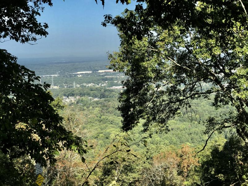
Georgia
From this viewpoint on Lookout Mountain, this valley would become battlefield after battlefield as far as the eye can see in 1863-64.
Chickamauga (1863)
We have been to the Chickamauga Battlefield up near the TN border but havent loaded all the photos yet. This is where little Johnny Clem (the 12 year old drummer boy) was captured by Confederates. Ironically, one of the Characters portayed him in reenactments in California! His story is facinating and our own middle school drummer boy is on the drum-line.
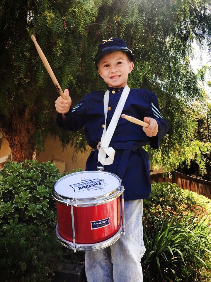

Here is our drummer boy now, same age as Johnny Clem at the Battlefield Visitor Center. in 2020.
The Atlanta Campaign
We live in battlefield central! There are battlefields and historical markers here and all over the state. One of the decisive campaigns in the war was Atlanta. Some were major battles, some were skirmishes, some were just markers or places of a significant event. Neighbors always mention how they find a relic in their yards while gardening. Relics are still found from both armies that marched, camped, fought, and died here 160 years ago as the war was coming to a close.

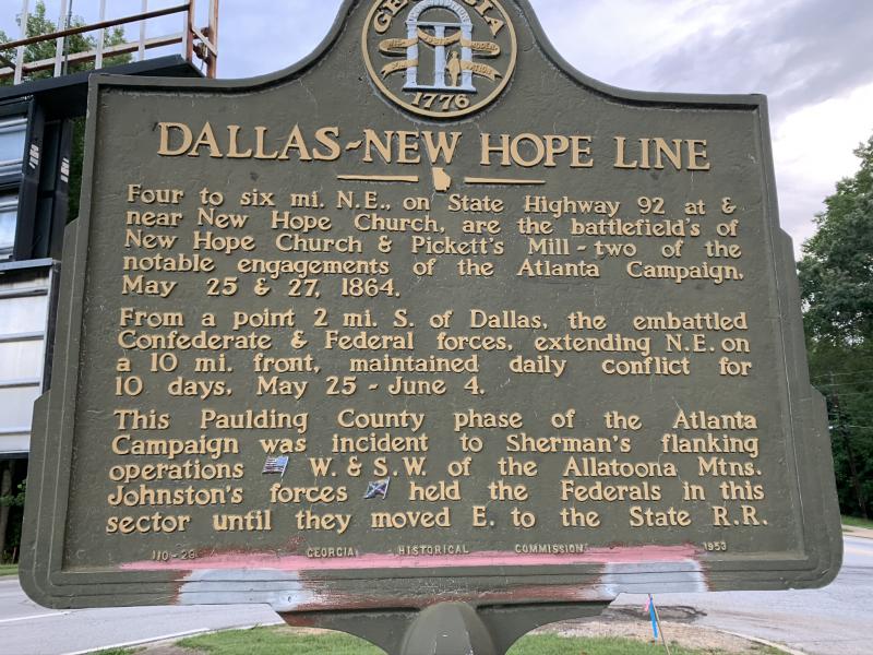
C. New Hope Church
(May 25-26 1864)

V

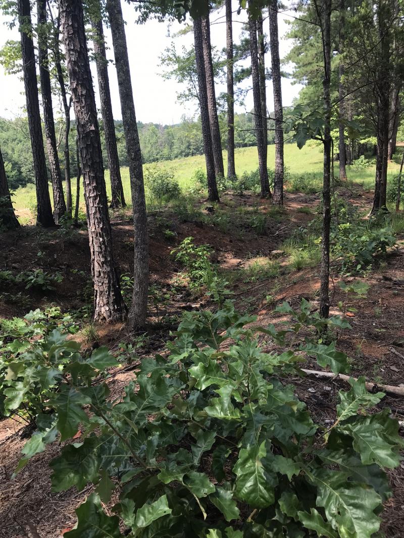
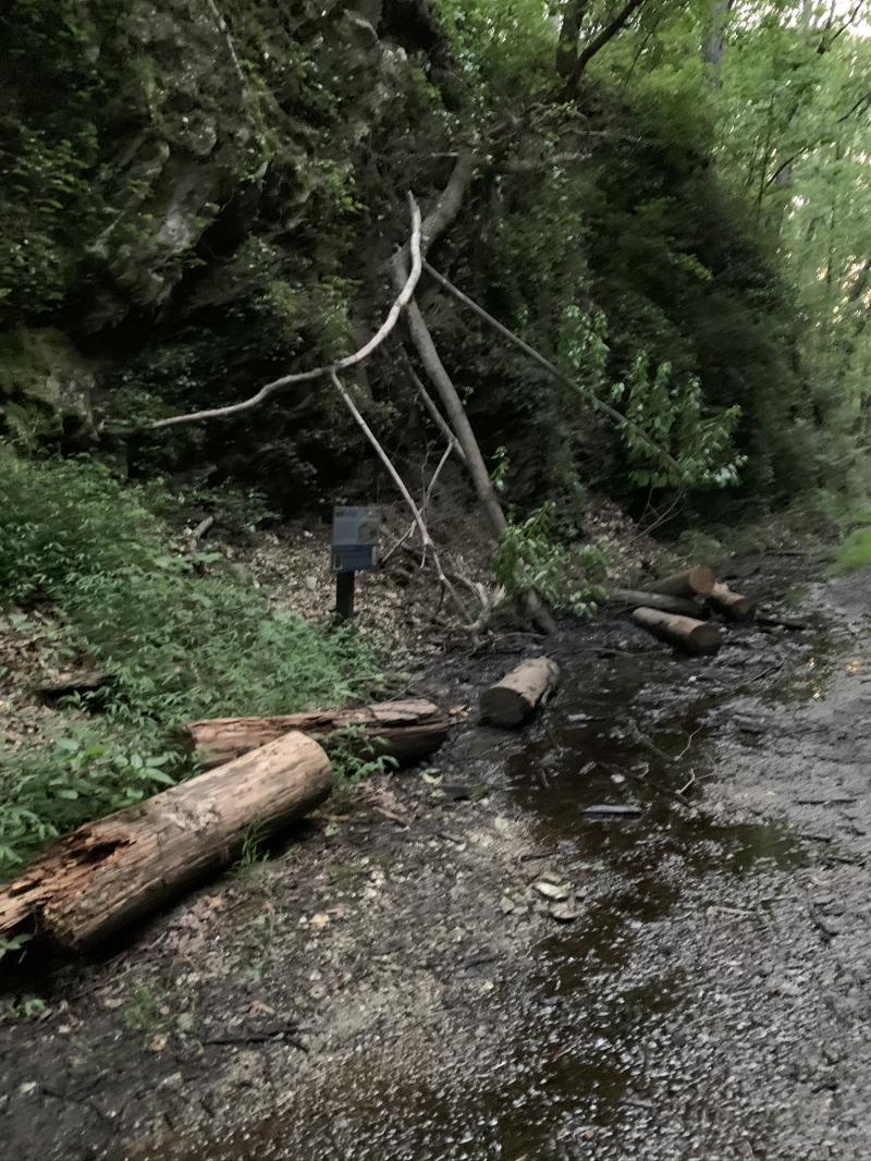
Nearby is a small preserve of the "Hell Hole". It was not easy to get to as it is along the road behind and between houses, but the handy app from Battlefields.org was helpful in getting close to the area (directions at right). We parked on nearby Johnston's Way off Old Cartersville Rd. and walked along the road until we found an inlet through the trees/brush. Here is a 360 video view of the photo below.


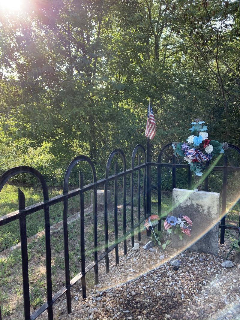
Lots of graves with no names and small stone markers here. Benjamin W. Pickett is buried here. He was part of a GA regiment and was killed in the battle of Chickamauga, his farm was the site of the next nearby large conflict: Pickett's Mill.
D. Pickett's Mill
(May 27, 1864)

Pickett's Mill is a nicely preserved battlefield park. Lots of wooded trails and we've found its easy to get lost!

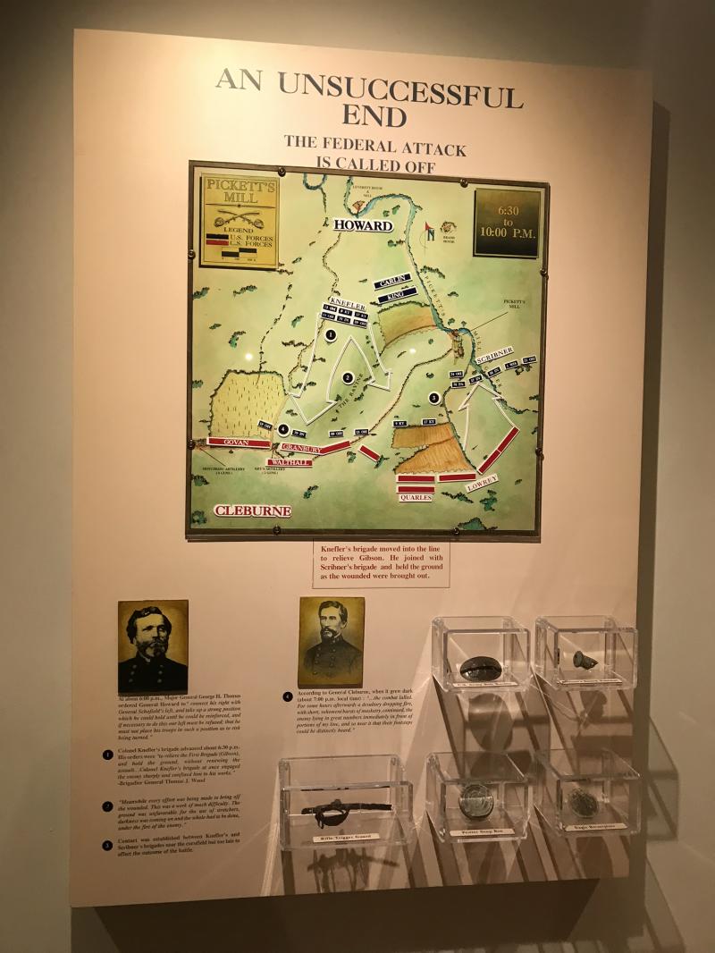
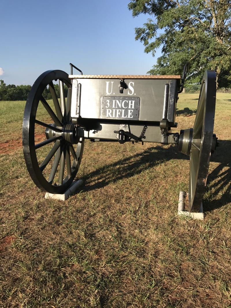
Stepping out from the nice Museum, is a platform. We didn't realize at first the platform overlooks the ravine which is the battlefield. Similar to Hell Hole at New Hope Church, Union soldiers died in trenches as Rebel artillery 12 lb. howitzers cannons fired a minute apart from the nearby field (right).

Artifacts and battle details are in the museum.

E. Dallas
(May 26- June 1 1864)
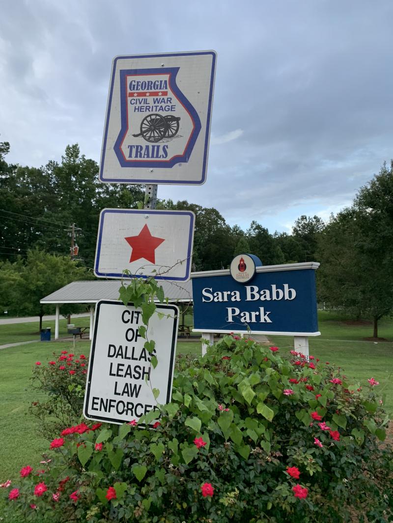
There isn't mu,ch left here to see. There is a marker at the street crossroads and a Georgia Trails marker that leads you to a Park with some info.
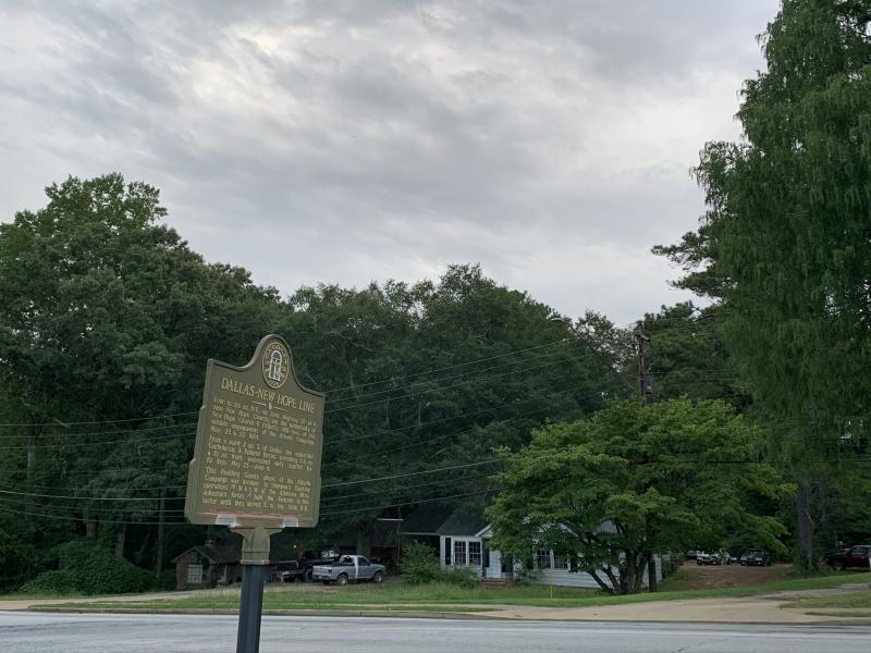

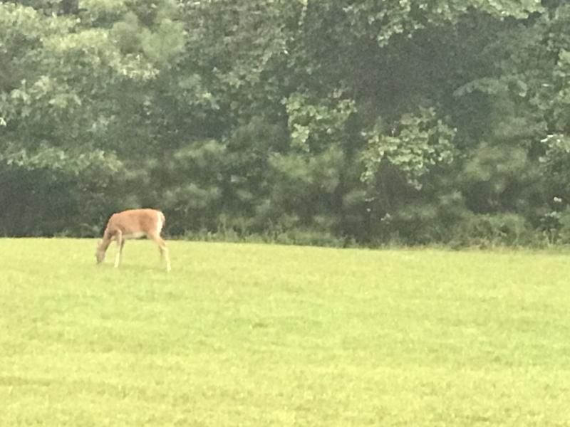
We enjoyed seeing deer grazing on what would have been a battlefield.

The markers at the Sara Babb Park
Pine Mountain & Polk
(June 10, 1864)

A short distance from here is Pine Mountain. More of a hill than a mountain, it played a roll in the conflict. With Rebels on the hill, Sherman below decided to flex his guns sending cannon shot up to those above, causing them to take cover. Not wanting to seem afraid to his men, Bishop-General Leonidas Polk was slow to turn back and as a result took a shell directly to the chest. He was killed instantly. An obelisk marks the spot atop the mountain (right).

Above is the the top of Pine Mountain, Lost Mountain and Kennesaw Mountain are both visible from here.

Bishop-General Leonidas Polk was co-founder of Sewanee University of the South about and hour south of Mufreesburo, TN. What remains of his house is now an archaeological site by the University. It is a beautiful and peaceful campus there.
Gilgal Church
(June 5-17, 1864)

After abandoning Pine Mountain, the Confederates formed a new line at Gilgal Church. Above is a reconstructed church used as a museum which is now also abandoned and in disrepair (as of 2/2020). The original log cabin Baptist church was completely destroyed within 15 minutes of the battle; blown off it's foundation.

Time has not been kind to this site. In just a few months it looks like a jungle. We do hope someone is interested in in restoring this piece of history! The below photo was taken August 2020. Its very easy to miss the turn in for this and is marked by a historical marker labled: "Due West Community".

F. Kolbs Farm
(June 22, 1864)

This battle seemed spur-of-the-moment as troops from both sides were moving to secure their positions at the base of Kennesaw Mountain and begain fighting as they literally ran into each other. Union got their intel from captured Rebels here at Peter Valentine Kolb's Farm, and the Rebel General had not surveyed the land to know what his troops were getting into.

G. Kennesaw Mountain & Cheatham Hill
(June 27, 1864)

The pinnacle of the fighting in this area is the Battle of Kennesaw Mountain. "Kennesaw" derives from the Cherokee Indian "Gah-nee-sah" meaning "cemetery" or burial ground." (Wikipedia.com). Such an impression was made that the town's name was changed from Big Shanty to Kennesaw as a result.

Memorial field is next to the Visitor Center (above, right, & bottom photos). I can't wait to get a pic of this with the fall leaves!

This is a sprawling Battlefield park, there are many trails and there is a road to the top. Under normal circumstances, one could drive their own vehicle up during the week, drive to the top, park and explore. The weekends had a shuttle. All of that was closed because of the Pandemic, but could not find any updated info on that. You can still park and use the site and the Visior's Center is now open (everything except the theater). You will need a Park Access Pass which is $5 per day. Get the 411 here.
A view of the Atlanta Skyline from the top

And the surrounding city of Kennesaw
Looking at Little Kennesaw (below)

G. Cheatham Hill
(June 27, 1864)

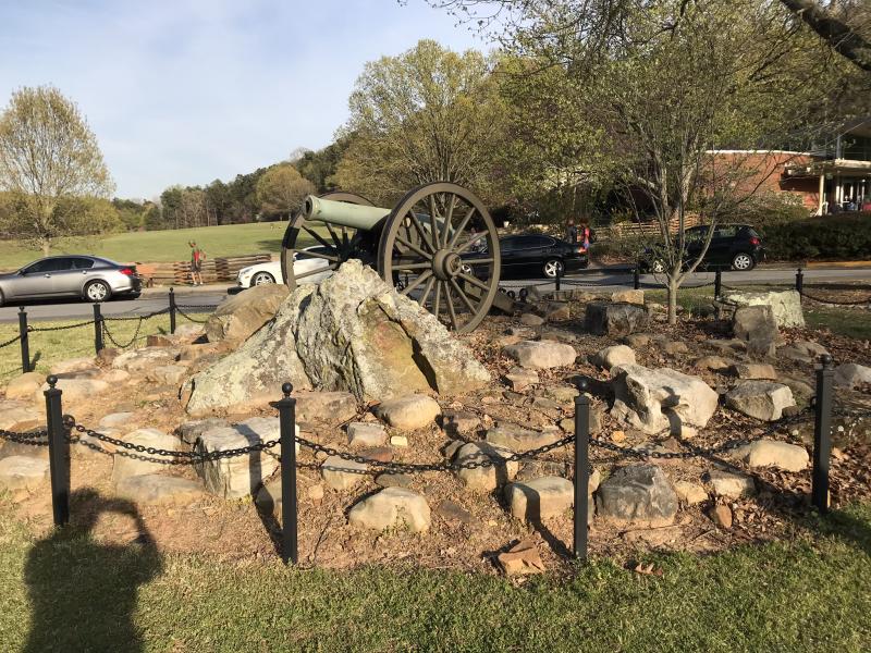
This is one of my favorite spots and was a little difficult to find at first. My first 2 days in Georgia, and I spent and hour driving around trying to find it. It was well worth it! On the path, one of the first things you'll come to is the field where Sherman's camp was. There are the above cannons overlooking it.

There is really a lot to see here. Markers indicate which Rebel regiments were where and correspoding cannons.

One of the strategies at play here was the Angle defensive. This is key to understanding this battle (above). You will pass many original earthworks from 160 years ago.
As you near the back of a huge white stone monument, this field below comes into view.

You'll quickly realize that below was the field where 8,000 Union troops were positioned to advance upon the Confederates dug into the earthworks on the hill you are standing.
The Dead Angle

The fighting here was intense. The Union progressed up the hill from the field (below) using their bayonets and tin cups to dig out defenses in the hilside, and became dubbed "the Dead Angle".
It eventually came to hand to hand combat.

There are more foot trails from here that can be taken.
 Facing the field is this monument to the Illinois as many of those here perished here were from that Company.
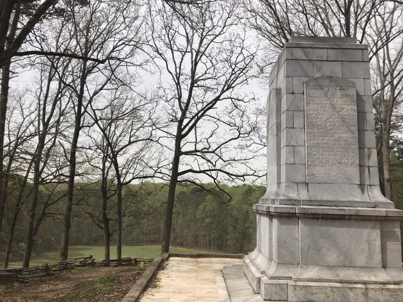
The inscription decicated to all the Illinois regiments who fought here (right) also details the battle.
As I stood at this spot for the very first time a crisp April morning contemplating the gravity of this situation, I had moment of silence for all who lost thier lives here. Interrupted by wind picking up and rustle in the treetops, I looked up but I could n't see the trees moving. Down at my feet however, the leaves were blowing directly toward me! I was able to get it on video (watch here in slo-mo) and had a moment of connection that my prayer for these souls was heard!

For the Virtual 156th anniversary of the entire Kennesaw Mountain campaign, see their Facebook page and scroll down to the end of June time frame for a treasure trove of demonstrations and information! There are usually live demonstrations/reenactments but due to Covid-19, it was all online.
Speaking of Reenactments
Before we get into the bulk of the next Battlefield (there's a lot of info due to several trips there), here are some re-enactment shots from our time in California.

Union troops march from a battle, this one was an April 1864 recreation in April 2016.

In the Union camp with 'President Lincoln' and 'Ulysses S. Grant' in the background.

At a reenactment at St. Catherine's Military School in Anaheim, CA in 2010, there was a dress-maker's tent and an antique sewing machine with all kinds of fashions of the 1860's that could be purchased or made. We typically make our own dresses and uniforms.
Allatoona Pass
(October 5, 1864)
After 5 trips here in 1.5 month's time, we have finally seen everything!
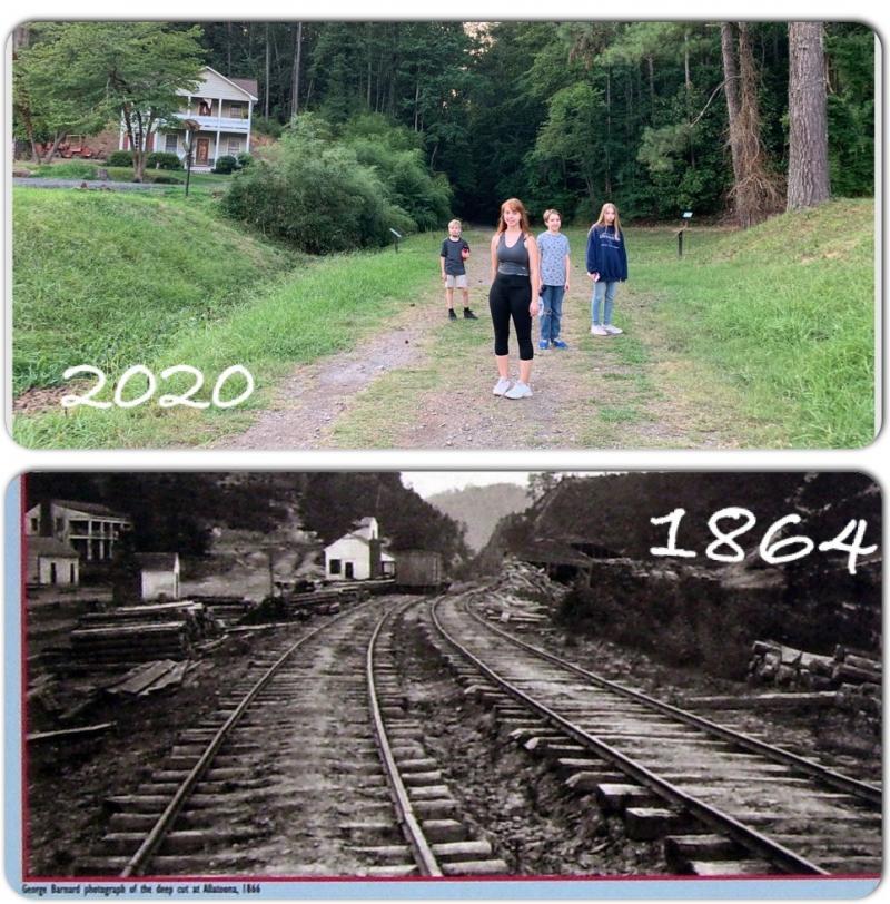
Above is the actual pass of Allatoona. You can walk what remains of the railroad tracks in the Deep Cut all the way through the pass to Allatoona Lake, and walk the many trails to makers with information about the historic events occurring here in October of 1864. This was after the fall of Atlanta. The Pass was a tricky part of strategy for both sides and was avoided until absolutely necessary.
 The cut comes up along what is now Allatoona Lake. The beginnings of the man-made lake stems from the Battle as Union soldiers purposly broke the dam to flood the area in an attempt to stop the advance of the Army of the Mississippi. It is a recreation magnet today.
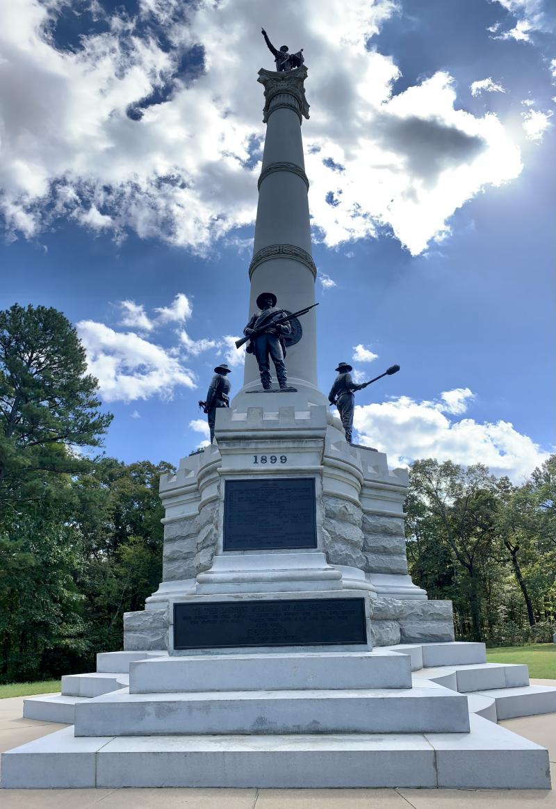
 Right next to this are monuments for the 11 states of men whose army's clashed here in the October 4-5th battle.

Behind you is another sign with a map. Before heading up the Wagon Road to the right, this gives an indication of what there is to see here (below):
The Deep Cut, The Tennessee Wagon road that connected Chattanooga to Atlanta, the service road used by 4th Minnesota to their camp and over to the Signal Point/Federal earthworks, Rowett's Redoubt, Eastern Redoubt, the Star Fort, and burial site of the Unkown Hero.

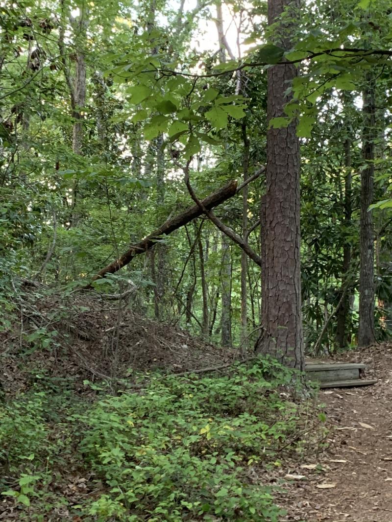
On the east side of the Cut along the Wagon Road there are a few trails. At the first fork, you can go left toward 4th Minnesota, or right toward Signal Point. There are no signs marking this, but the above map indicates this is where they are which is correct! If you go left first, keep following the trail past all th downed trees and once barricaded trail (remnants are still there). You'll see you're back on the path as you will come to a sign indicating this was the Headquarters of the 4th Minnesota.
4th Minnesota Headquarters
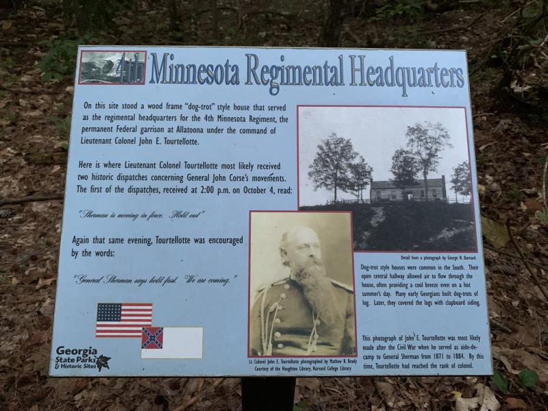 Here once stood a dog-trot sytle house that was used as the headquarters of Lt. Col. of the 4th Minnesota. You wouldn't guess since the reforestation of the area after the war leaves no room for a house! It was here word came 2x from General Sherman to "hold the line, we are coming" in which a Hymn was inspired by a re-telling of this battle.
The popular Battle Hymn of the Republic was also inspired by the movement of Union troops early in the war in Washington D.C. and was written in the dark after a bolt of inpiration in her hotel room by abolishionist writer Julia Ward (read that story here).
The Deep Cut

Is there more? We kept sending a scout up ahead on the trail to see if there's more and sure enought one of these blue signs comes into view. We are glad we did not miss the overlook to the deep cut (a foor bridge was once here) and we timed it perfectly as the train was passing on the re-routed tracks next to the Cut; see that here!
Eastern Redoubt

The trail looks like it loops around, but we went back the way we came on the military service road, crossed the wagon trail and kept going on the trail that was the 'military service road' to the Eastern Redoubt.

Remnants of the Redoubt are still visible. They are earth built up to protect soldiers as their cannons fire over them. Lt. Col. Tourtellotte was wounded here. See the video 1 and video 2 to get a 360 view of these earthworks.
Crows Nest/Signal Point

The sign is here but the actual tree needed to be cut down as it had died. It was used to make into cigars boxes & gavels and sent to Confederate generals as gifts and to the Smithsonian in Washington D.C.
Federal Earthworks near the Redoubt
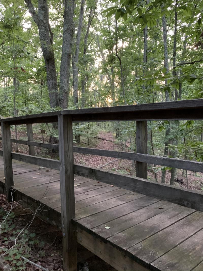
From here, the trail loops around to the Federal Earthworks. This bridge crosses over them, and you can see the works looking toward the sunset.
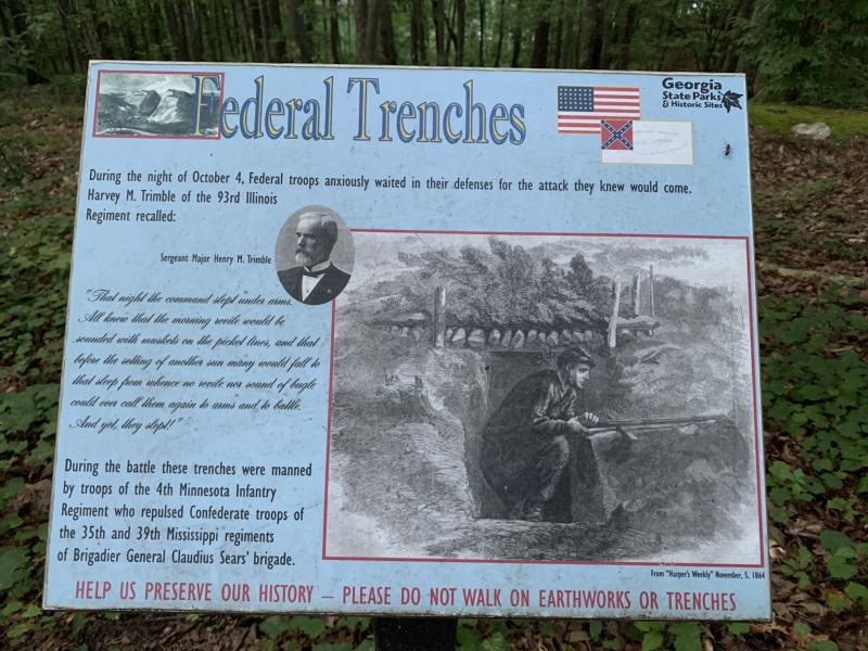
The above sign gives a good idea of how these trenches were used. Here is video along the sunset path to the trenches.
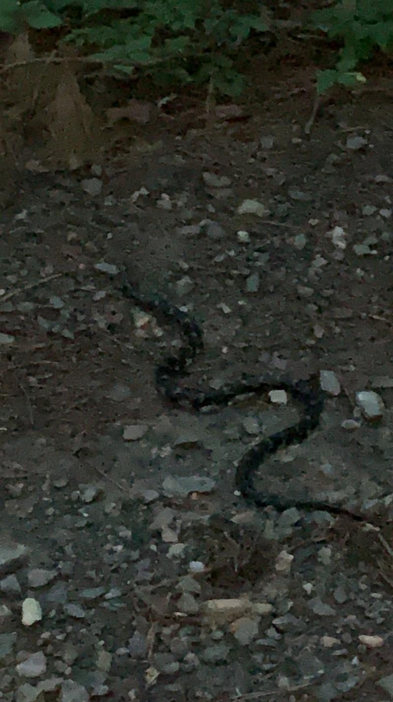
On the way back down the Wagon Road to the Deep Cut, I almost stepped on an Eastern King snake! Watch the video here.
Inside the Deep Cut

Western Side Above the Cut

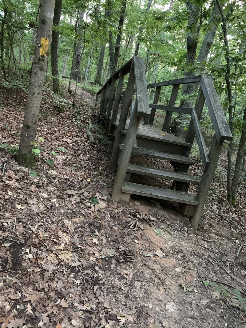
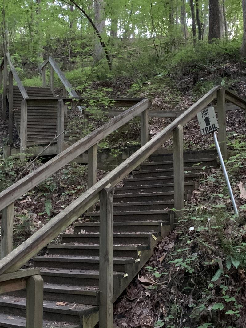
Before getting to the Star Fort, you will ascend up the stairs (right) and then up a steep dirt trail with embedded wood steps. You will come to the 1st sign which is this:
Rowett's Redoubt
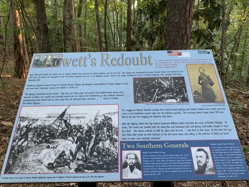
This details the earthworks here that protected the Star Fort and the Southern Regiments that stormed it. The next sign visible is this one to the right.
The Star Fort

700 Union were on top of each other defending this Fort. Inside the fort, seems small when you realize just how many men were in here!
See the 360 video of the Star Fort here.
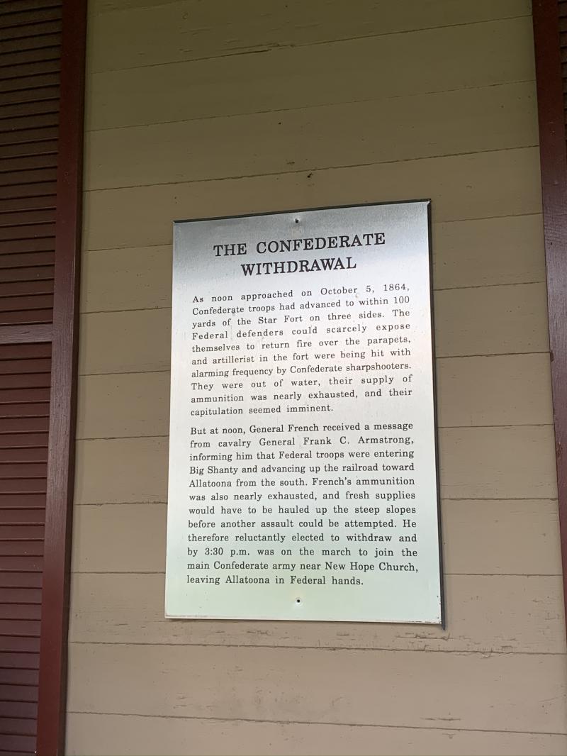
Confederate Withdrawl: Word of Sherman's reinforcements coming from Kennesaw Mountain got here and due to the heavy loss and waning supplies, the Confederates withdrew, not wanting to be cut off from New Hope. They were within 100 yards of the fort when the decision was made to withdraw. It took weeks to gather the dead and wounded.

Grave of the Unkown Hero
The only way down is the way you came up!
Heading further down the Cut, the next sign is the Grave of the Unknown Hero.

Heading further down the cut, the road bends, but the locals take the path to the right down to the shore

There is a small trail to the shoreline


Headed back down the cut. You can see the detail in the rock that was carved out for the train to pass.

After exiting the Cut, a relic of the war stands to the west of where the tracks were.
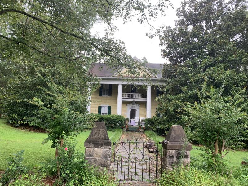
It is the Clayton-Mooney House. This is an intriguing original structure that is a time capsule for this battle with many stories to tell. We got a close up look at this house.
Clayton Mooney House

We are unsure of this house's occupancy status, but if it's not lived in, it's owners are nearby. We've been told they open the house at the battle's Anniversary for tours. We were respectful of their property and just wanted to get an idea of what is there since they do open it up to the public for tours. There are still visible bullet holes inside and out, and still visible are blood-stained floors upstairs (we have seen the photos)!


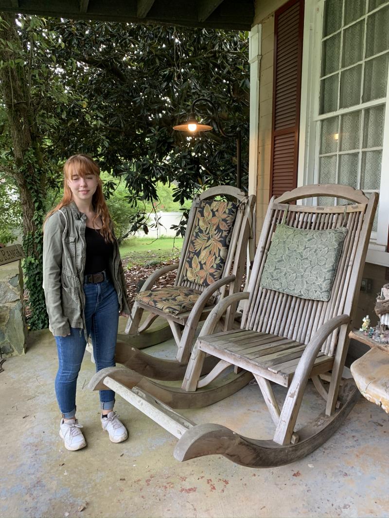
The porch chairs are huge!

On the north chimney, there is a memorial plaque. There are old marker signs scattered around as well as on the porch.


Allatoona marina can be seen from here by walking up the embankment. There are reenactments on the Battle's anniversary. 2020's is on October 3rd. Get the 411 here.
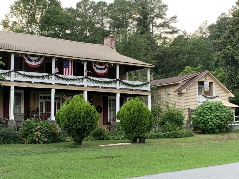
Next to the Clayton Mooney house is the historic Lake Allatoona Inn.
Relocated Grave of the Unknown Hero

Situated along the rerouted train tracks is this grave. Allthough the person who is buried here is unknown, he represents all who fought and died at the Battle of Allatoona Pass.

Red Top Mountain State Park and the GA Dept. of Natural Resources have done a great job preserving this area.
For more information, here is a site packed with info and links about some of what we've detailed here including the ghost stories about Allatoona Pass: Exploresouthernhistory.com
The Lemon House
Not far from this spot is the Lemon House. This was the house Sherman took over and used for his headquarters for this part of the war.

The man of the house was fighting for the South while the wife and her infant remained in the house and fed/quartered General Sherman and his company. It is said it was ordered to be burned down but when Sherman was far enough away, the fires were put out. Most of Acworth burned in the March to the Sea, and this is one of the few remaining original structures of the era.
Coming soon:
Kennesaw House
It's been visited, photos/details loaded soon!
March to the Sea
These have been visited:
Fort Polaski
Macon Cannonball House
Photos/details loaded soon!
It's a fact that thoughout our world's development, there were battles, big and small. Here are some of the battlefields in key conflicts in the Civil War the Characters have been to.
Pictured here on the Manassas Battlefield in Virginia, this snapshot represents the true nature of this ugly but necessary war of brother againt brother. The highest number of Americans of any war were killed in this conflict. The exact number is not known, but estimates range from 600,000-800,000 which would equate to 6 million in today's population percentage.
The Last Battle: Appomattox

Events of April 9, 1865 pictured above. Who was at the surrender? See a detailed picture below on the left side. 
At the McLean House in Appomattox, Virginia, the room today looks exactly as it was for the surrender. It was reconstructed after the house was dismantled in 1893 to be moved to Washington DC but put back together again on the original site in the 1940's.

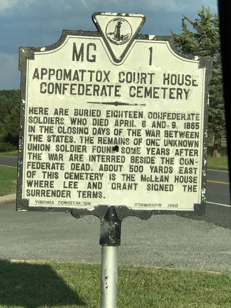
There is a cemetary at the battlefield (left & above)

A look outside the upstairs window has a bird's eyeview of the battlefield.
Manassas/ Bull Run
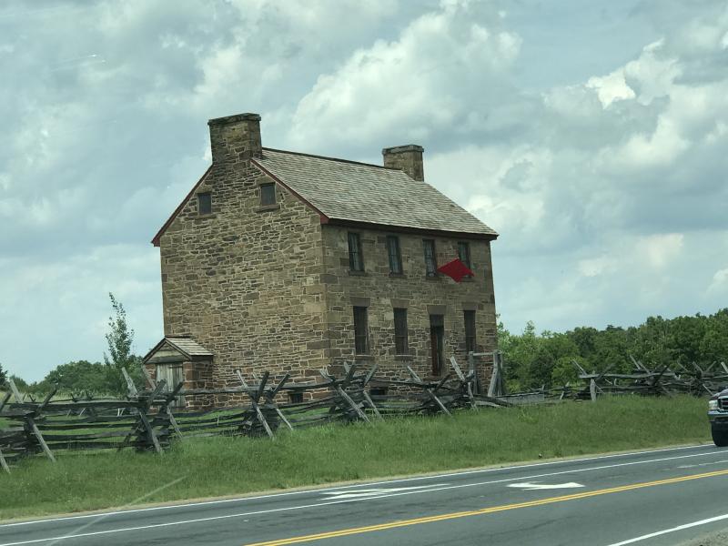
The Stone House
Used in the 1st and 2nd Battles as a hospital, heavy fighting occured around this house and it was taken over/controlled by each side during the battles.

The Henry House (rebuilt), there are nice interactive displays inside.
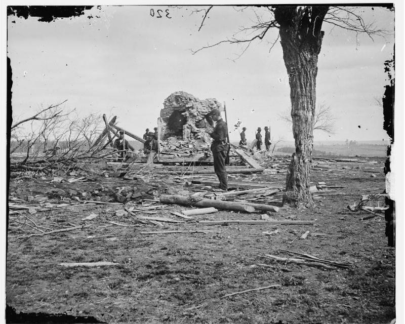
National Achive photo
Henry House completely destroyed after 2nd Manassas
During 1st Manassas, the bed-ridden owner of this house was killed by a shell.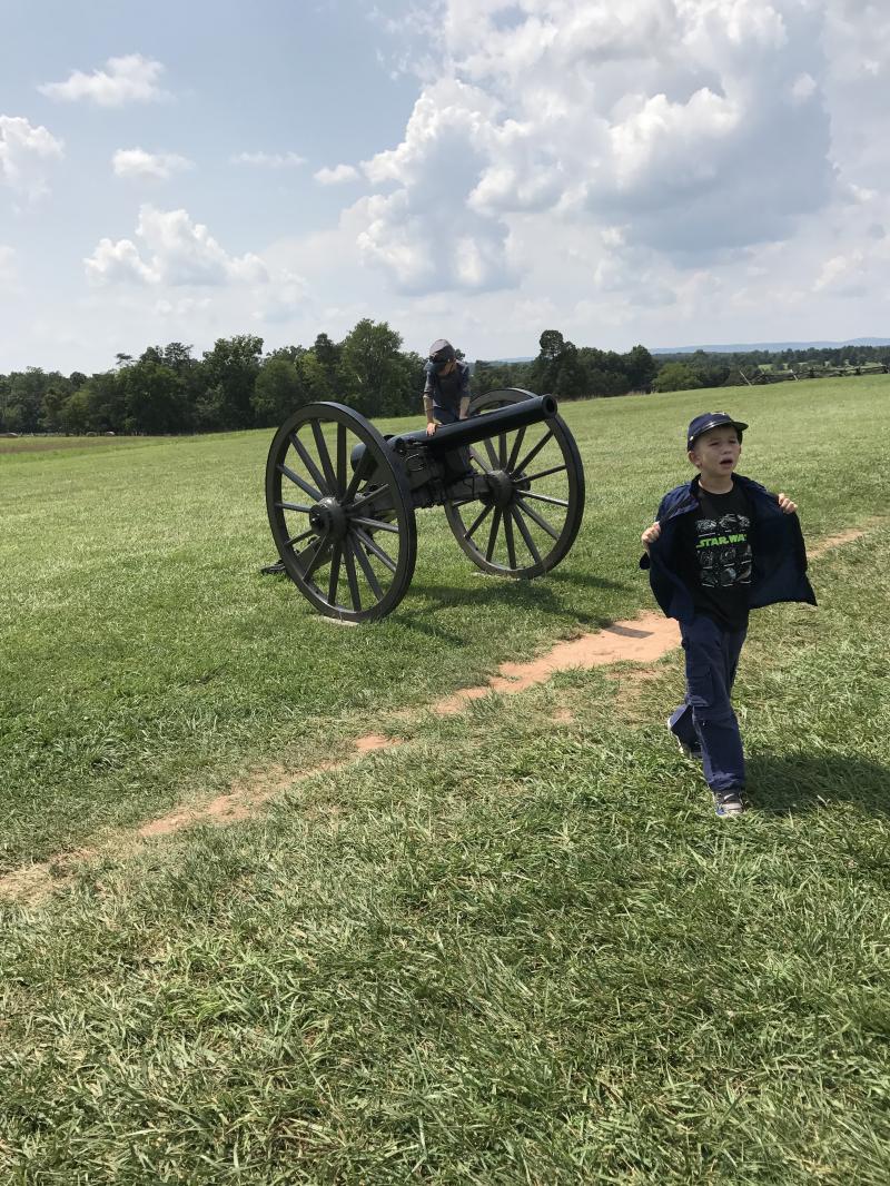
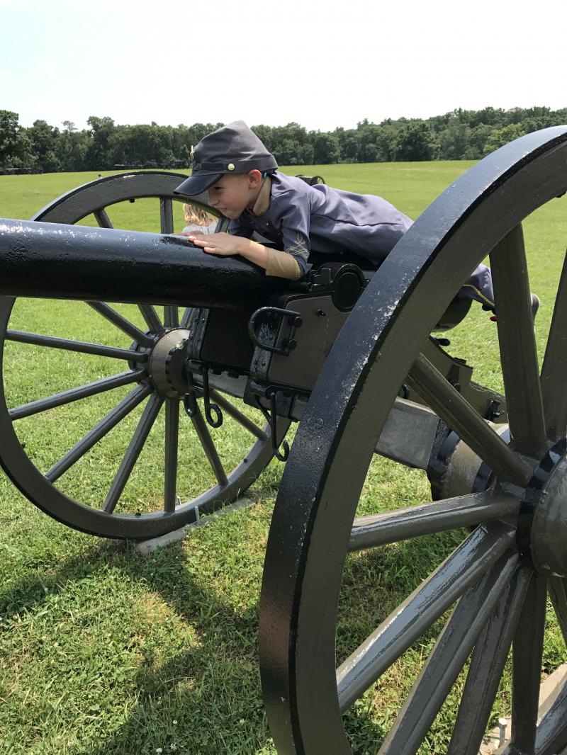
Hot on the battlefield in uniform in mid-July, almost to day of the anniversary of the 1st Manassas.
Original Union uniforms were wool to prevent ignighting oneself with his own weapon. One of the Character's ancestors was a Brigadeer General in charge of overseeing outfitting the troops out of New York. He later became the 21st President of the US.
The South had mainly cotton.
Chickamauga

Brotherton field and main theater for the battle, there are many monuments for all the regiments who fought there

Above is the Snodgrass House on Snodgrass Hill
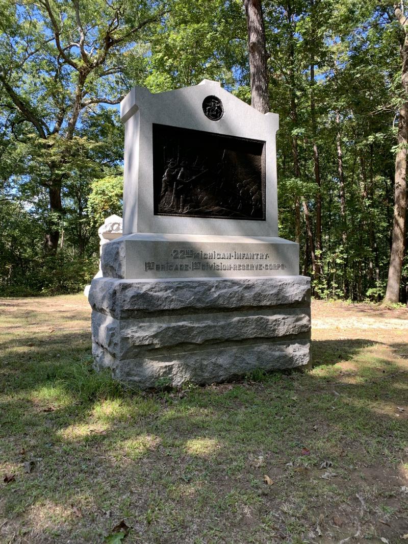
Monument to the 22nd Michigan (Clem's Unit) on Horse Shoe Ridge

Inside the Visitor's Center
There is an extensive military gun collection as well.

The Atlanta Campaign
As the Union travelled south along the railroad line, it's main goal was to cut off the South's main supply line and bring it to it's knees. Here are pics from recent visits corresponding to the chronology and letters on the map to the left from: www.battlefields.org/learn/maps/atlanta-campaign
C. New Hope Church

Dubbed by Union soldiers as the "Hell Hole", Sherman underestimated the strength of the Confederates at this location. Trying to flank them instead of attack along the railline, the North took heavy casualties (3x as much as the South) as they were caught in trenches as the trees and brush were thick.

The cemetary across the street was part of the battlefield as Confederates used headstones as sheilds not wanting to dig in the graves. There are still earthworks in the area remaining to this day and a 10 mile stretch along Dallas-Acwoth highway can still be seen. Men from both sides are buried in the cemetary.

Here is an achival photo of the trenches dug.

Finding the "Hell Hole"
D. Pickett's Mill
After an incomplete attempt to stop the Rebels at New Hope, Sherman decided to try to flank their right. Hastily Sherman ordered an attack ready or not, this resulted in te Battle of Pickett's Mill.
The Union saw it as a total loss and gained nothing. 600 men died or were wounded in the ravine below.

We were looking for the field below and got lost. We found ourselfves in the ravine of death and it was eerie.
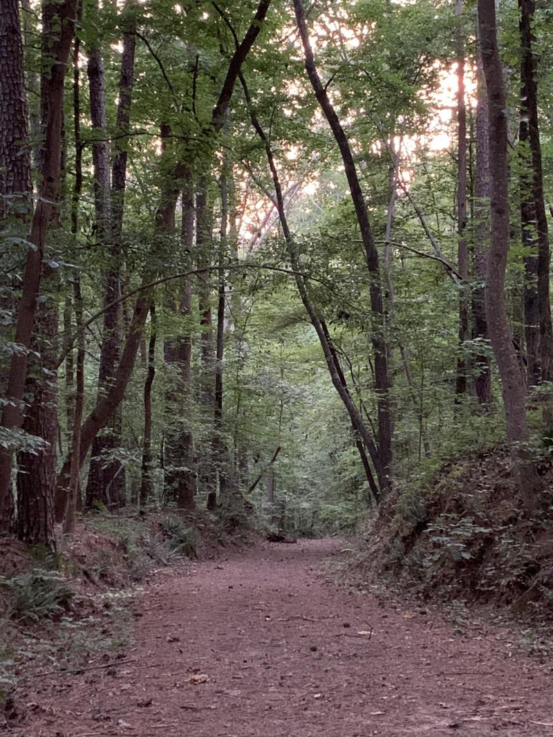
Above is the trail to the field, which opens to a road which led to Leverett's Mill, to the right, Pickett's Mill.

not far from the field is a little Cabin used in the movie Get Low. It's also used for reenacments and living history. It is original (1853) but moved to the site from a short distance away.

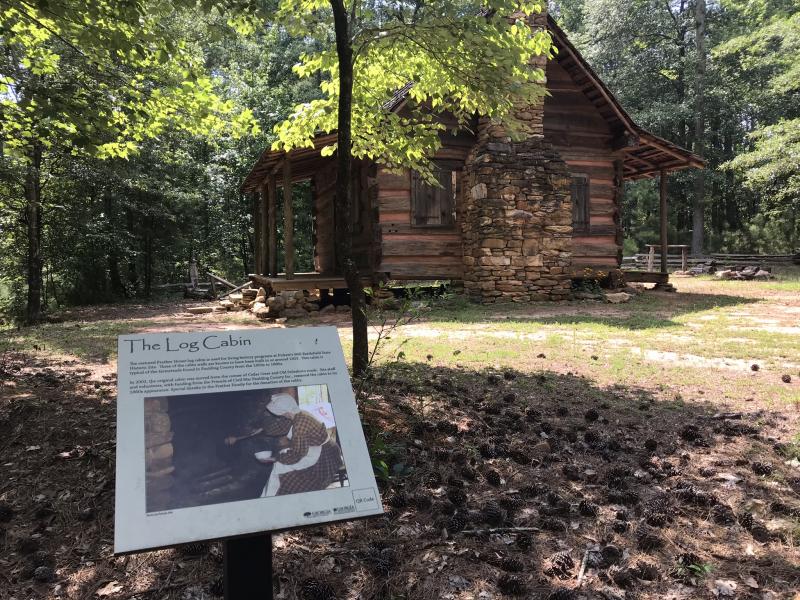
Get Low stars Robert DuVall, Sissy Spacek and Bill Murray.
E. Dallas
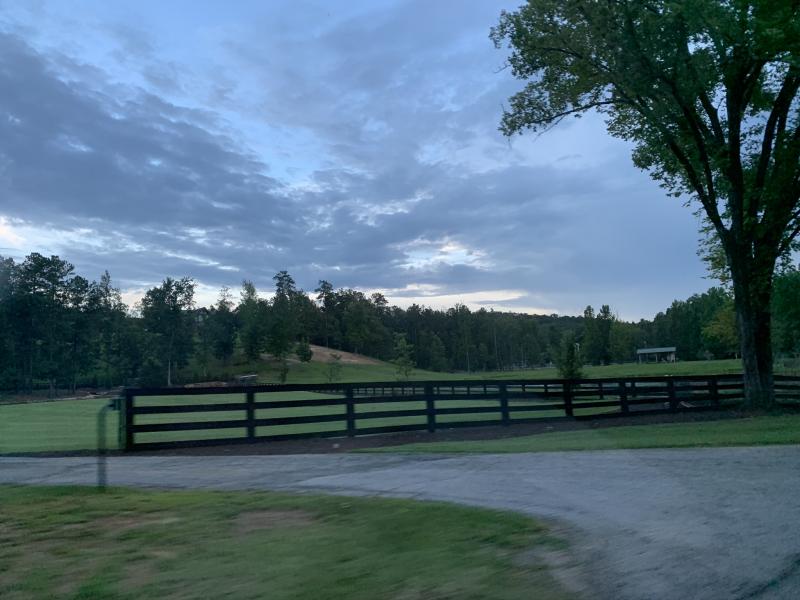 What was the battlefield is a public park and private property

Pine Mountain & Polk

Below is Rebel's Rest in Tennessee at the Sewanee, University of the South's campus. It overlooks what is left of Bishop-General Polk's house. Read their recent statement in regards to it's past here.

Gilgal Church

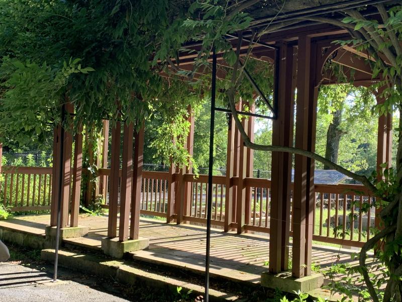
These ramparts are a recreation of what was here constructed by General Clebourne's division. There is a ravine below and the terrain is what saved the Union from a full-scale disaster.

We had fun swinging from a vine way up in the tall trees. February 2020 proved for easier poking around than August as the brush would have been what is was like when the battle was fought.

After the skirmishes here, the Rebels settled at the base of Kennesaw & Little Kennesaw Mountain for what would be the biggest action of the campaign before taking Atlanta. The first being:
F. Kolbs Farm
 This is the only surviving original building in the entire Kennesaw Mountain campaign. It is a government building (looks like for storage) and is closed to the public.


The Rebels retreated but their losses were costlier than anticipated. As mentioned at right, the Rebel General (Hood) hadn't surveyed the land so they were retreating into unknown thick brush, swamps etc. and lost 1,000 men to the Union's 300 lost at this battle.
G. Kennesaw Mountain & Cheatham Hill
Beautiful, well-kept grounds and Visitor Center (which is closed due to Covid-19).


The grounds are peppered with authenic cannons and is home to various wildlife, big and small. A bear was just captured and relocated. Read the exciting story here!
A view from the top
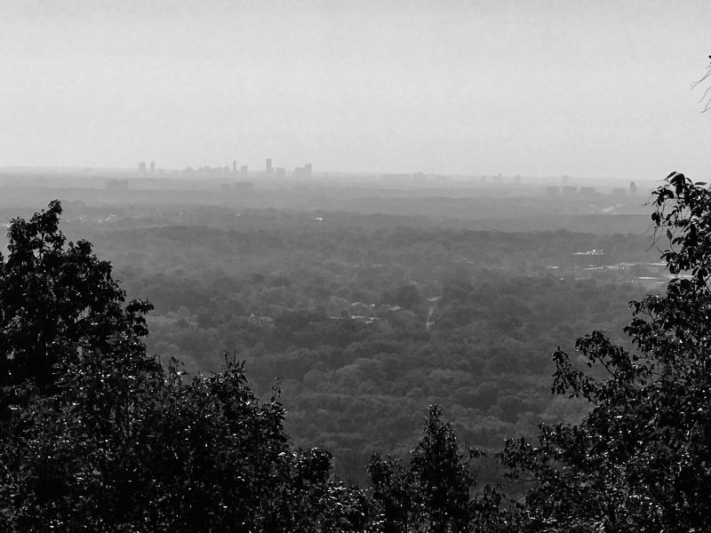
Captured a breathtaking view of the skyline of Atlanta on a relativly clear October day. I monochromed the photo for a clearer picture. Below is a hazy February day.

Lots of info all around!

In Septemeber 1864, the goal of the Atlanta Campaign was complete. In the coming months, the Union would deliver the final blow to bring the South to it's knees tearing a destructive path along both rail lines the length of the state to the Atlantic coast.

There are lots more trails and cannons at the top. Including one over to Little Kennesaw. There is a marker at the view point near the top detailing the duelling cannons' fighting between the twin mountains and what it took to get those heavy cannons up the hills.
G. Cheatham Hill
 There were horse lessons on Sherman's field!
Keep driving down the road and you will see another stop and a monument to the Texas regiment that fought there, at the end of the road is a parking lot, and you'll know you've found it!
Original trees are still here and some of the tops have grown improperly as the result of bullets and cannon fire (below). One such tree riddled with bullets from this spot is in a nearby museum.

Earthworks

Positions on the hill and field below.
There was a 7 hour battle break as a Confedreate leader waved the white flag to pause the battle to gather each side's wounded as the heat and ammunition fire here was so intense, it was catching the grass on fire and burning those lying on the ground.

Several officers fell here and the spots are marked


27th Illinois Infantry
34th Illinois Infantry
36th Illinois Infantry
42nd Illinois Infantry
44th Illinois Infantry
51st Illinois Infantry
73rd Illinois Infantry
74th Illinois Infantry
78th Illinois Infantry
79th Illinois Infantry
85th Illinois Infantry
86th Illinois Infantry
88th Illinois Infantry
100th Illinois Infantry
125th Illinois Infantry
5,350 men were lost in these battles, and was declared a Confederate victory.
Beauty on the Battlefield
There were about 5-6 deer grazing during a thunderstorm here on a July day. There were several more along the road out to Dallas highway that were unfazed by joggers passing close to them!
Here is a video of the deer and the thunderstorm. Ironically, the only two places we've either been struck or close to it (like feet away) from lightning was in Illinois (near President Lincoln's house) and here in Georgia (behind our house)!
Reenacment Photo Break

Sitting right in the crossfire of the battle, was our expereince at Calico Mine in Southern Cal, February 2015. The dogs hid under my hoop skirt as cannon fire shook the hill.

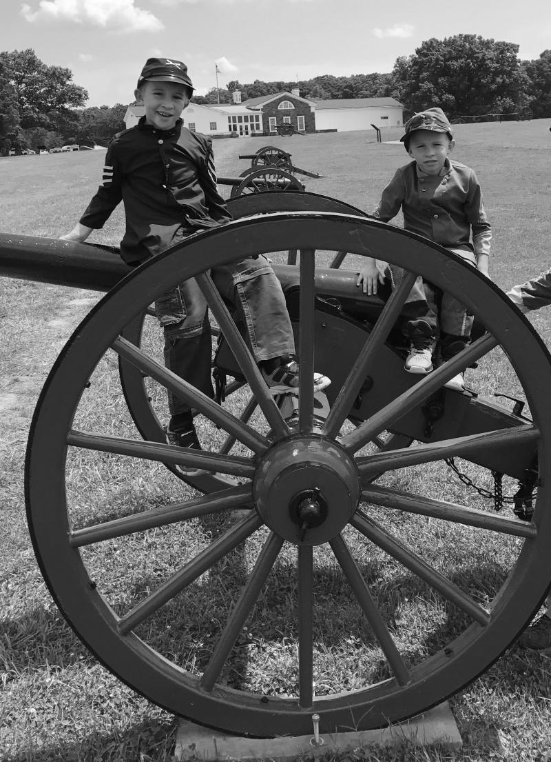
Getting a good idea of what it was like to load and fire a cannon on the hill.
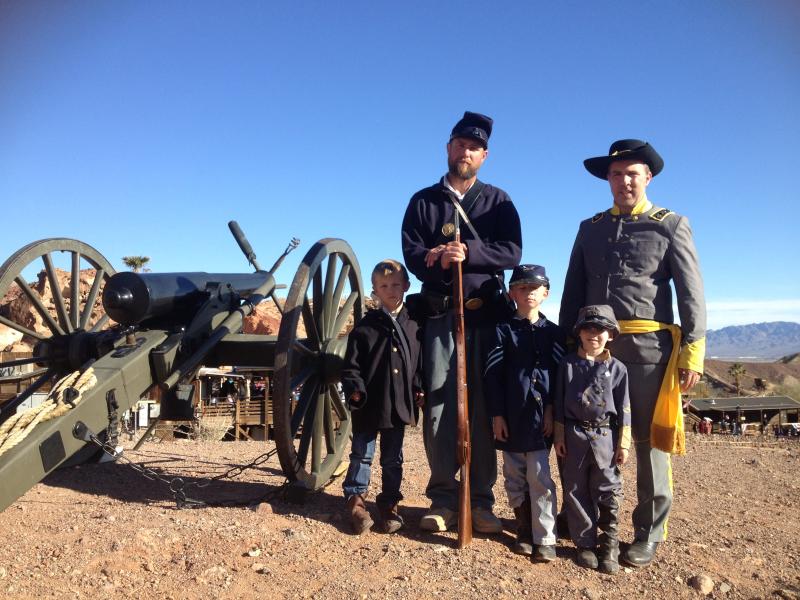
in our expereince in CA, most reenactors want to be Union, but usually you get assigned where needed. The AM battle is a recreation that of one that is won by the South, the PM battle is always Union which was the pattern in the real War.
Allatoona Pass
 One of the main attractions is the Deep Cut. This is the cut in the rock to allow the Western Atlantic trains to pass though as this considered the Southern Spur of the Appalacians.

We walked the entire Cut during the day, and also at night.
I have read converstaions among the locals who say they will not dare enter the Cut at night as it is haunted. There is even a book about that topic. My only concern was running onto a bear as we heard branches break in the brush as we walked. That night a bear was caught not too far away around the same time!
Tennessee Wagon Road

 The Wagon Road also drops you off at the lake. We later went rowing and tubing in the lake!
There were a million tiny toads hopping along at the end of the line here and overflowing trash can.

 We thought it interesting that just about the spot of where Lt. Col Tourtellotte's headquarters once was, was a little turtle in the path! We know the name is French for a type of bread, but all the letters for turtle are there!
Eastern Redoubt

Map of the Trail

Continuing on from the Redoubt on the trail toward the lake shore is the Crow's Nest.
The signal flag was seen by General Sherman 18 miles away on Kennesaw Mountain. Can you see the mountain top in the distance in the photo above?
The 60 foot Georgia Pine towered on the hill here and grew intense sniper fire when the flag was raised.
Federal Earthworks/Trenches


There used to be a rope swing around here as all the locals mention it. It is no more as it is said someone met their end on in and it was taken down.

Inside the Deep Cut
About 1/2 way in, you'll come to the remnants of a foot bridge. You can definitely see where the foot bridge was above the Cut and this sign marks the spot along the Western side of the path.


Near where the sign is, are the stairs leading up above the western side of the Cut to the trails to the Star Fort and Rowett's Redoubt.
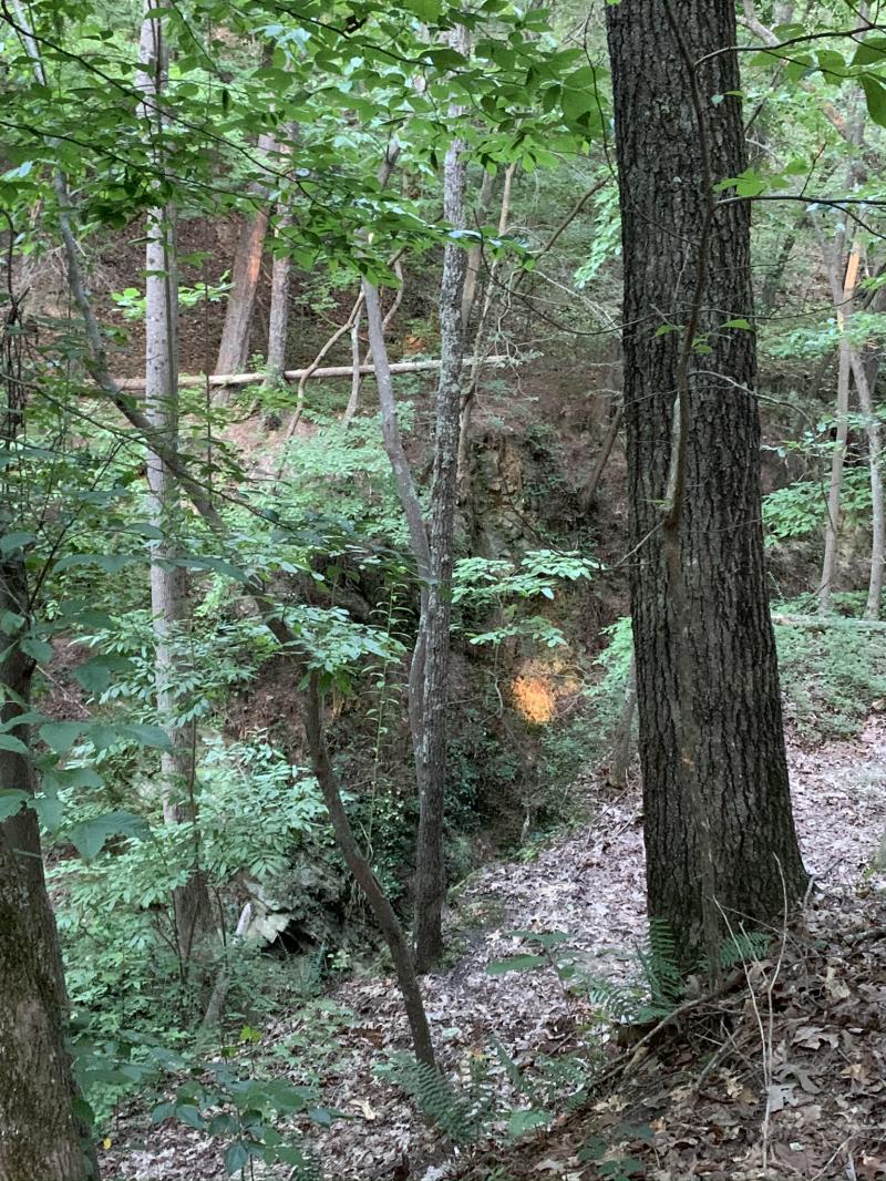
From the top of the western side of the cut looking down.
Rowett's Redoubt

Inside the Star Fort (below)
Grave of the Unknown Hero
Sent to Allatoona in a wooden box and buried by the train tracks by 6 women is one story. Local histoians believe it is the grave of of a Mississippi officer who was buried where he fell.

The sign at left details both accounts. he was later moved to a spot along the current tracks, which will be detailed further down.
Heading further North down the Cut.

On the way back toward the parking lot
Clayton Mooney House

In the photo from 1865, teh Clayton-Mooney House sits to the left of the train tracks.
As the battle here at Allatoona ensued, the Clayton-Mooney house quickly became a hospital.

The front yard marker indicated that here are many unknown Confederate dead buried throughout the grounds.
 Bullet holes are visible in the south chimney.
In the yard, are old marker signs for various point along the site detailed above.


Directly across the street form this house (near where this photo was taken), are old Railraod Crossing signs.


The current tracks

Unknown Hero Grave
The sign in the Cut read that the relocated grave is 1000 yards south of the Pass trail entrance. I stumbled upon it accidentally! 
Here is exactly where it is located along the train tracks. We stopped and waited for the the train carrying lots of coal to pass, and didn't realize that if it weren't for the tall grass, the grave was almost in my video (left of the photo below)! Continuing south on Allatoona Pass Rd. SE, the impression for the original railroad can still be seen on the hillside.

The Lemon House


It's on Lemon Street just off of Main. The Lemon family is all buried in a nearby cemetery. Her husband did return from the war. 